
East Moline ZIP Coverage
Official USPS bulletins support one current principal East Moline postal designation and one older delivery line. They do not support an invented list of every PO-box or unique ZIP variant. This ZIP code directory therefore labels the evidence precisely. Use the current line for a modern search, but retain the older number when transcribing a letter, directory entry, deed, or newspaper notice.
| ZIP Code | Areas Covered | Post Office | Notes |
|---|---|---|---|
| 61244 | Current principal East Moline postal designation | East Moline delivery line | Verify each specific address |
| 61282 | Historical East Moline-area delivery designation | Replaced last-line instruction | USPS said to use 61244 for affected deliveries |
| Other variants | Not established by the inspected official source | Check USPS directly | No unsupported all-ZIPs claim |
The table describes postal status, not a polygon. A delivery address can use a city name even when another government boundary applies. East Moline also crosses layers used by Rock Island County records, including township, school, fire, tax, ward, and TIF districts. A ZIP line alone cannot select the right assessor or prove municipal jurisdiction.
East Moline ZIP 61244
The 2016 USPS Postal Bulletin lists East Moline, Illinois, with 61244. That makes 61244 the supported current principal ZIP for this East Moline ZIP code directory. It remains wise to confirm one full address through USPS because a city-level listing does not show the exact route boundary, every special-use code, or every delivery exception.
The assigned capture preserves the official postal entry.
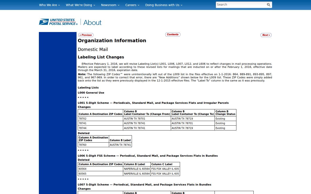
This source supports the city and ZIP pair without pretending that the bulletin supplies a street-by-street boundary map.
East Moline covers 14.6 square miles and had 21,374 residents in the 2020 Census, according to city background material. Those facts describe the municipality. They should not be treated as statistics for the postal delivery area unless a Census product is specifically labeled for the matching ZCTA.
Why East Moline Records Say 61282
A 2007 USPS Postal Bulletin tells affected deliveries formerly using 61282 to use East Moline, Illinois 61244 as the last line. This is a strong postal-history clue. An old envelope or directory line with 61282 is not automatically wrong, and it should not be silently changed when cited. Record the number as printed, then add the later USPS transition when comparing it with a current address.
This change also helps date loose family papers. It cannot date an item to an exact year by itself, but it can distinguish a historic delivery format from a modern one. Search both numbers in scanned newspapers and archives. Modern government forms may accept only the current five-digit value, while an optical-text search may find the older number exactly as printed.
Postal comparison. Treat 61244 as the current principal East Moline ZIP and 61282 as documented historical evidence, not as two interchangeable current codes.
East Moline ZIP Versus ZCTA
The Census Bureau's ZCTA guidance explains a common mismatch. A ZIP Code Tabulation Area is a generalized area built for statistics. It approximates where addresses use a five-digit ZIP, but it is not the live USPS carrier boundary. Label population, household, or demographic values as ZCTA data when that is what the Census table supplies.
The Census explanation appears in the captured reference.
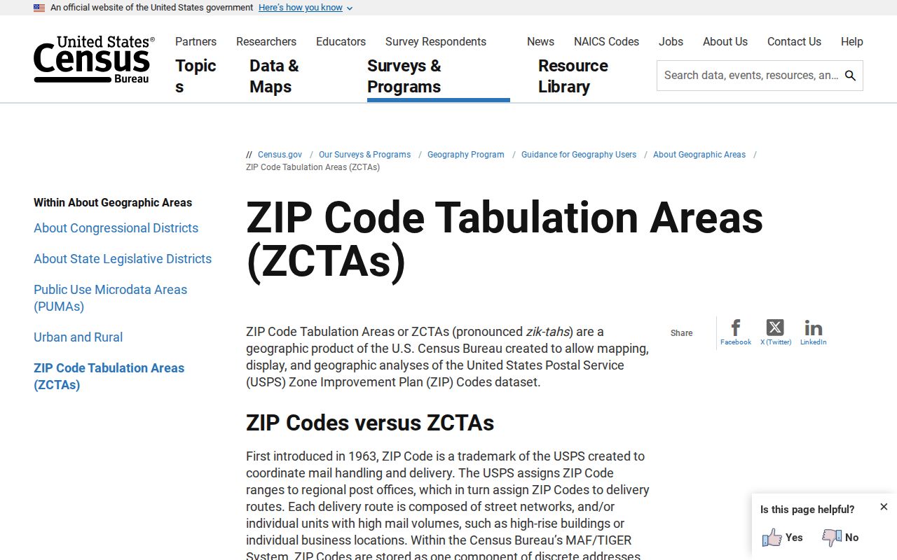
The distinction protects this ZIP code directory from assigning a ZCTA total to East Moline city limits or a USPS route without proof.
Find East Moline Residents by ZIP
Official systems use ZIP fields in different ways. The Illinois voter tool requires a ZIP as one part of a specific registration confirmation. I-Cash accepts ZIP as an optional filter on a name-based unclaimed-property search. IDFPR documents a ZIP field for public credential searches. The county parcel search does not expose a separate base ZIP field; search the house number, street, and city, then read the site ZIP on the resulting record.
- Copy the complete postal line exactly, including 61244 or a historical 61282.
- Confirm a current delivery line with USPS, and keep Census ZCTA data separate.
- For a parcel, search Devnet by street and city, then read the resulting site ZIP and township.
- Use the voter, I-Cash, registry, or credential ZIP field only for that system's defined task.
- Once a ZIP yields a street, use the East Moline street directory for the address-level record chain.
Do not ask a ZIP-wide tool to prove occupancy. A parcel names an owner or tax-bill party, a voter form confirms a supplied match, and a license search confirms a credential. Each output retains its own meaning.
East Moline Voter ZIP Fields
The Illinois Online Voter Registration Lookup uses five-digit ZIP as a required identity field. It does not permit a broad 61244 roster search. First name, last name, birth date, and ZIP are required at the first stage. Street number and a populated street-name choice are required next.
| Lookup control | Required | How ZIP works |
|---|---|---|
| First name | Yes | Part of a specific identity match |
| Last name | Yes | Part of a specific identity match |
| Birth date | Yes | Entered before address stage |
| Five Digit Zipcode | Yes | Maximum five characters |
| Street number and name | Yes, second stage | Qualifies the registration request |
The Rock Island County voter guidance explains local registration, changes, cancellation, and contact routes. Its assigned capture shows the county fallback.
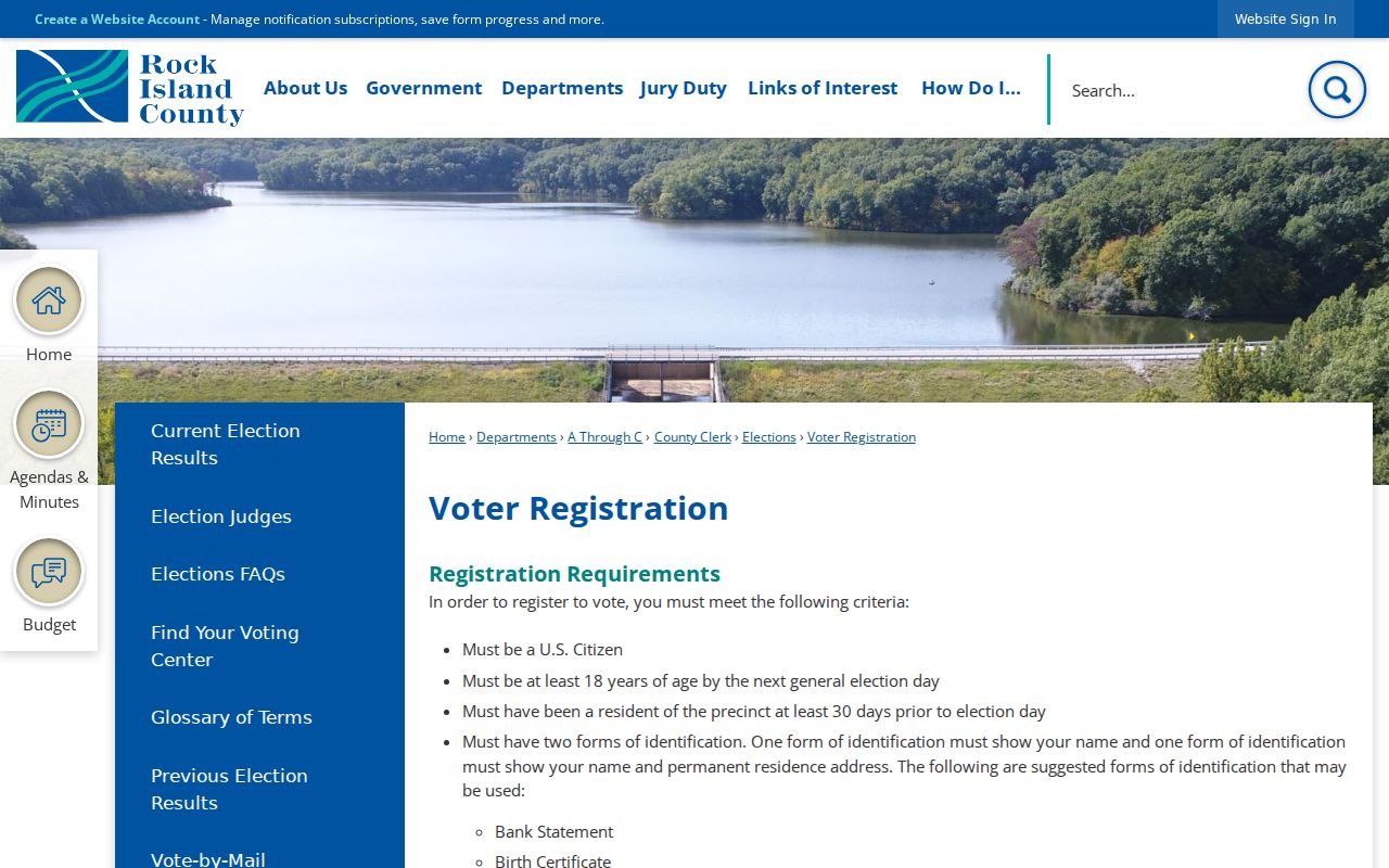
When the state form fails, contact the County Clerk. Illinois restrictions and redactions still prevent a ZIP code directory from becoming an unrestricted voter list.
Other East Moline ZIP Searches
Illinois I-Cash accepts last or business name, first name, city, ZIP, or property ID. Use it to find a possible unclaimed-property lead, then follow the claim process with proof. A matching 61244 is a useful filter, not proof that the named person now lives in East Moline. The Illinois professional-license lookup also documents a ZIP field, while the state registry supports a narrow public-safety search by ZIP under its disclaimer.
The Illinois I-Cash claim search is shown in the assigned image.
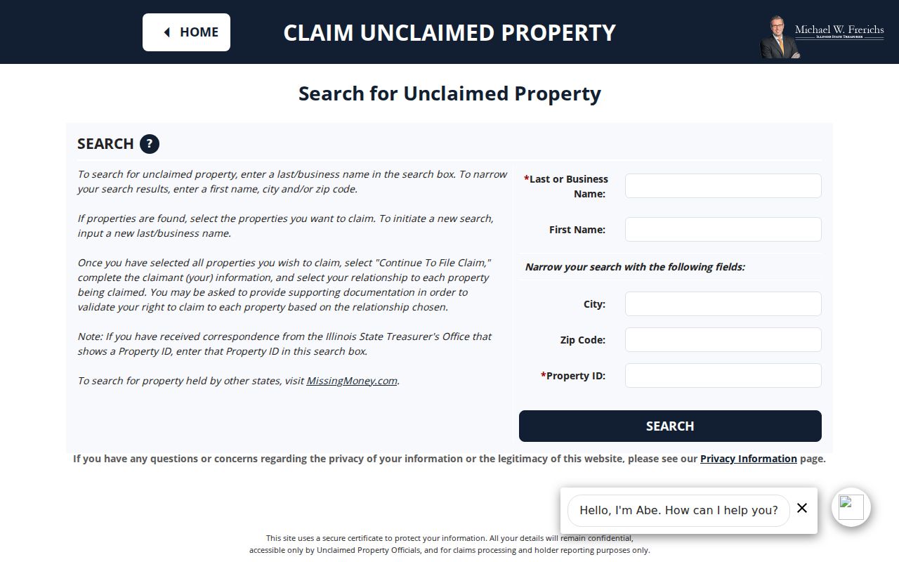
The image demonstrates why a city or ZIP is a narrowing field. The state still requires claimant evidence before releasing property.
Historical newspapers work differently. The RICHS archive uses city, title, and date controls rather than a ZIP field. Search 61282 as text, then repeat with East Moline, Watertown, or a street name. Library computers, local historians, and archive staff provide access when an online search does not index the needed scan.
A ZIP Is Not a Township
Rock Island County parcel systems show why 61244 cannot stand in for every map layer. A sample East Moline situs appears in South Moline Township, while the same card carries East Moline city, school, fire, and TIF district labels. Hampton Township can also matter for East Moline assessment work. Postal city, municipality, township, ward, school district, fire district, and tax district answer different questions.
Devnet searches by PIN, owner, address, sale, township, district, property class, and tax year. Its base search has no separate ZIP control. The GIS parcel popup may expose site city, state, and ZIP after an address, owner, or PIN search. For in-person help, use the county Assessment Office or the correct township assessor. For deed and plat facts, use the Recorder instead of treating the map as title proof.
Note: Read the site address and tax-bill address separately; neither field alone proves who occupies an East Moline building.
East Moline Postal Place Names
Older records may use Watertown, Port Byron Junction, Rock Island Junction, Moline, or a regional Rock Island title. Watertown was platted in 1856 and annexed in 1914. These names are search terms, not errors to erase. A legal description, plat, parcel map, directory scan, or city archive entry can connect an old place label with current East Moline geography.
When no renumbering table exists, work address by address. Search the City Clerk archive and municipal FOIA form, review Recorder plats and legal descriptions, compare directory pages, and ask RICHS about maps. Research found no official citywide street-renumbering year, so any exact transition needs evidence from those sources.
East Moline ZIP and City Limits
USPS ZIPs organize mail delivery. East Moline city limits organize municipal authority. Census ZCTAs organize statistics. None should be substituted for another. The inspected sources did not provide a current 61244 boundary polygon or a complete list of special ZIP variants. Accordingly, use “current principal ZIP” for 61244 and verify one address through USPS, Devnet, GIS, and the relevant government office.
City geography is still useful context. East Moline lies along the Mississippi River, with I-80 crossing the community, I-74 to the east, and I-280 to the south. Those anchors help orient a map, but they do not define a carrier route. The same caution applies to historic Watertown and Junction labels.
- ZIP vs ZIP+4
- A ZIP is the five-digit delivery area; ZIP+4 narrows mail to a smaller delivery segment.
- PO-box ZIP
- A code used for post-office-box delivery rather than a mapped neighborhood.
- Unique ZIP
- A code assigned to one high-volume organization or institution.
- Carrier route
- The sequence of addresses served by one postal delivery route, which can change without changing city limits.
A safe ZIP code directory states what each source proves, preserves historic postal lines, and sends uncertain modern addresses to the custodian. It never turns a delivery code into a list of occupants.